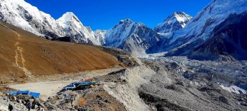
Top 5 places to visit in Lumbini
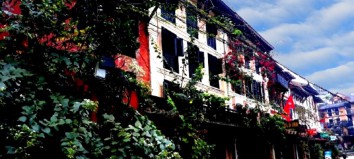
Lumbini:
Lumbini is internationally recognized as the birthplace of Lord Buddha. It was inscribed as a UNESCO World Heritage Site in 1997 in recognition of its Outstanding Universal Value. in particular, UNESCO identified that Lumbini is one of the holiest and significant places for one of the world’s great religions.
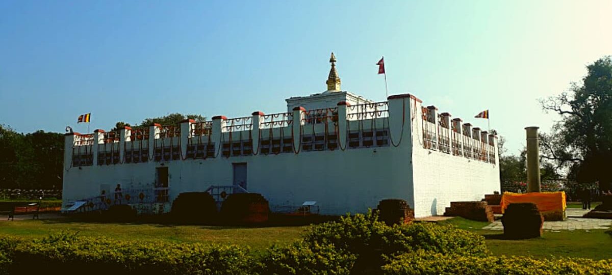
The recent UNESCO Project funded by Japan revealed the presence of the earliest Buddhist shrine a simple timber fence enclosing a tree. This tree would have been identified by the first pilgrims as the tree under which Lord Buddha was born. Radiocarbon dates indicate that this occurred at around 550 BCE, broadly about the same time as his mahaparinirvana or great passing away. Over time, the timber fence was replaced by large brick kerbstones, and the surrounding area was paved with brick to create a prayer platform.
In 249 BCE, when the Mauryan Emperor Asoka made his pilgrimage to the site he built a small structure of timber and mud, with an open courtyard for the tree. The walls were covered in plaster and painted white, black, red and yellow. Shielded from the outside, the center of the structure remained unroofed and open. The Marker Stone later became a focal point of worship. Asoka also erected a ten-meter high pillar to the west of the temple. The inscription on the pillars identifies the location as Lumbini, the birthplace of Lord Buddha which Asoka visited in the twentieth year of his reign and that he exempted the local village from taxes.
Eventually, the temple was expanded further, and by the Gupta period (4th – 7th Cent. CE) it was reconfigured as a seven bayed structure with a carved and molded brick opening to the east. The temple became fully enclosed, the Marker Stone was buried and the tree was no longer present. We do not know if it was a natural or deliberate end to the tree’s life.
Karma:
The small fort’s layout is almost identical to that of Dohani. The two forts form a direct line between Lumbini and Tilaurakot Kapilavastu and were designed as stopping points for pilgrims, officials and traders moving between Lumbini and settlements to the west. The fort of Karma measures 49.5 x 43.5 meters and has rounded bastions on each corner. The ramparts are nearly two meters high, and the fort was surrounded by a two-meter deep moat. When a team from Durham University and the Department of Archaeology extracted auger ore samples, no cultural material was recovered. This suggests that the fort may not have been fully functional after it was constructed and that, unlike Dohani which was built over a pre-existing settlement, it was founded on virgin land.
Dohani:
A low rectangular mound, the first formal investigation of the site began with a subsurface geophysical survey in 2016. This revealed the presence of a square cardinally oriented fort, complete with rounded bastions on each corner. Measuring 50x 50 m, its fortifications share similarities with another Kushan period (1000 BCE – 300 CE) forts in the region, such as Araurakot and Karma. Dohani would have served as a stopping point between Lumbini and settlements to the west.
Excavations and auger coring in 2017 identified that the fort was constructed from brick-faced ramparts of clay on top of an earlier settlement. Possibly dating back to 1000 BCE, the pottery and material found in the lowest layers of Dohani are very similar to that from Lumbini’s village mound. Indeed, Dohani may be one of the longest-occupied sites in the Greater Lumini Area. to protect the archaeological remains, the trenches were backfilled again.
Tilaurakot – Kapilavastu:
Tilaurakot is recognized by most scholars as Kapilavastu, the city in which Lord Buddha spent the first 29 years of his life. It was from here that he left on his journey of spiritual enlightenment, departing through the Eastern Gateway. The site was first discovered by P.C. Mukherji in 1899, who traced the journey of the Chinese pilgrim Xuanzang from Srvasti. Questions over the identification arose again in the 1960s when Debala Mitra excavated across the northern rampart. She concluded that the site could be no earlier than the 2nd century BCE, and thus could not be Kapilavastu. This instigated a long debate over the true location of the city Tilaurakot or across the border at Piprahawa. Excavation by the Nepali archaeologists Rijal and Mishra began to expose more of the city, including the western and Eastern Gateway, the fortification walls and the Northern Stupas. However, recent UNESCO led archaeological investigation re-examined Mitra’s trench. Clay and timber fortifications were exposed, with the earliest palisade dating to the 6th century BCE, and thus concurrent with the life of Lord Buddha.
Geophysical surveys revealed the buried street plan of the city with roads running north-south and east-west and punctuated by small squares or plazas. At the very center of the city is a walled complex, with gates at each cardinal point. Between 2012 and 2017 some of these structures were excavated, including a small shrine, a deep brick-lined water tank, parts of the northern and eastern ramparts, large sections of the central walled complex, and some smaller building and houses. Outside the city, a Mauryan Period monastery has been discovered near the Eastern Stupa and an industrial zone to the south.
Nighlihawa:
The Mauryan Emperor Asoka erected an inscribed pillar in 249 BCE, recording his veneration and enlargement of the nirvana stupa of the earlier Kanakamani Buddha, one of the 27 Buddhas preceding Lord Buddha. The Chinese pilgrims Faxian (5th cent. CE) and Xuanzang (7th cent. CE) also described their visits to the pillar and stupa. Two fragments of the pillar were rediscovered in 1895, the upper portion was half-submerged in the bank of the Niglisagar pond, while the lower part of the pillar was partially buried. As the base of the pillar and plinth on which it once stood are missing, its original location remains unknown. Some scholars believe that it was erected at the natal town of Kanakamuni Buddha, which Faxian indicates is about one yojana( c. 11-14 km) west from the city of Kapilavastu. However, Xuanzang provides different directions and, as such, the town’s location remains unknown. Asoka’s pillar also bears a later inscription marking King Ripu Malla’s visit in 1312 CE.
Araurakot:
This fortified enclosure measures 270 x 270 m. the clay ramparts on its south and west are encased in brick, while those on the north and east are lower and unfaced. The brick ramparts are strengthened by stirrup bastions at regular intervals. Circular corner towers and a double moat are to be found on the western side. In 1899 P.C. Mukherji started excavations for the Archaeological Survey of India. He suggested that the difference in construction materials reflected the fact that Araurakot’s enemies were located to the south and west. However, it is equally possible that the site was only partially completed the site’s morphology bears a striking resemblance to the early first millennium CE military outpost found throughout the Kushan Empire. Although there have been no excavations within the site, a subsurface geophysical survey in 2015 confirmed the different constructions of the ramparts as well as the presence of five stirrup bastions. The survey also revealed that the interior was largely empty, except for a raised platform in the southeast corner with foundations of two buildings. Carved bricks similar to those from Lumbini, Kudan, and Tilaurakot have been recovered from the site, suggesting that is was occupied into the middle of the first millennium CE.
Sagrahawa:
Sagrahawa comprises an expanse of large and small mounds, clustered around a water tank. Excavations in 1896 by Dr. Führer from the Archaeological Survey of India exposed the remains of a large brick monument and smaller building at the western edge of the tank, as well as 17 small brick stupas to its southeast. The stupas were interpreted as commemorative of the death of the Sakyas the people to which Lord Buddha’s family belonged during the destruction of Kapilavastu by Virudhaka, the king of Kosal during the lifetime of the Buddha. Führer identified Sagrahawa as “the place of the massacre”, visited by the Chinese pilgrim Zuanzang in the 7th-century CE. until recently, the site remained unexplored and the previously monuments are now eroded and overgrown. A subsurface geophysical survey in 2016 identified a series of additional buried brick structures around the larger mound, indicating the presence of additional buildings, platforms or stupas, suggesting that this was a site of religious importance in the past.
Chatradei:
Excavations were first undertaken by the Indian archaeologist P.C. Mukherji in 1899, who suggested that the extensive ruins were most likely contemporary with Tilaurako. He documented ditches on the north and west sides of the largest mound and a boundary wall to its south. His excavations on the largest of the mounds exposed rectangular buildings decorated with carved brick. Later research by Debala Mitra of the Archaeological Survey of India in the 1960s suggested that the structures exposed by Mukherji dated to no earlier than the 7th century CE. This was partly due to the complex of cells to the front of the temple platform, an arrangement similar to that of the temples at Kudan, although the presence of carved brick suggests an earlier date. A subsurface geophysical survey in 2016 identified additional structures under cultivated fields to the southeast of the larger mound.
Kudan:
Kudan means “to jump”, referring to the local legend of a giant, who could jump from one mound to the next. The site was first identified by the P.C. Mukherji in 1899, recorded a row of four ancient mounds. In 1962 the site was excavated by Debala Mitra from the Archaeological Survey of India. She exposed two of the mounds, revealing large cruciform brick-built temples on either side of an ancient well. On the basis of the design of the exposed temple architecture and types of pottery, Mitra ascribed the construction of the temples to the 7th century CE, with later 9th century elaborations. Some scholars have suggested that Kudan may be the site of ancient Nigrodharama, the banyan grove where Gautama Buddha met his father several years after his departure from Kapilavastu, and where his son Rahul was ordained as a monk.